TxDOT Pedestrian and Bicyclist Count Data Program
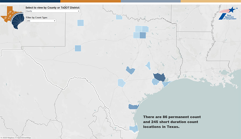
TTI has worked with the Texas Department of Transportation (TxDOT) since 2016 to improve the availability and quantity of pedestrian and bicyclist count data in Texas. The most visible product of this work has been a statewide database called the Texas Bicycle and Pedestrian Count Exchange, which is intended to be a one-stop location for all pedestrian and bicyclist count data in Texas.
TTI has produced several other guides and reports in this effort:
- Final Project Report – comprehensive project report that details multiple activities related to pedestrian and bicyclist count data.
- Guide for Seasonal Adjustment and Crowdsourced Data Scaling – technical detail on how to adjust short-duration counts in a particular month to represent annual averages, also how to expand Strava bicyclist samples to represent total bicyclists.
- TxDOT Bicycle & Pedestrian Count Resources – TTI developed and helps maintain this web page to highlight key resources.
Aggieland Bikeshare Analytics
In the spring of 2018, Texas A&M University launched an ambitious dockless bikeshare program, which included more than 3,000 bikes on the main campus in College Station. When used for a trip, each bike generated location data for the start and end of that trip, as well as the route taken. TTI developed an easy-to-use Aggieland Bike Share Dashboard for summarizing and visualizing hundreds of thousands of bike trips in the College Station and Bryan area. This bikeshare dashboard was used extensively by Texas A&M as they expanded their bikeshare program throughout 2018 and 2019.
Iteris PedTrax Evaluation

Traffic signal systems are becoming smarter and intersection sensors are have advanced monitoring features beyond simple traffic detection. In the spring of 2019, TTI evaluated the accuracy of Iteris’ PedTrax feature, which automatically counts the number of crossing pedestrians using intersection video cameras. TTI used a rigorous benchmark evaluation process to quantify the pedestrian counting accuracy of Iteris PedTrax at two intersections in College Station, Texas. The rigorous evaluation process has subsequently been used in several other independent evaluations of pedestrian counting systems.
FHWA Traffic Monitoring Guide
The Federal Highway Administration (FHWA) maintains a Traffic Monitoring Guide, which is considered the bible of traffic monitoring for state DOTs. In the 2016 edition, TTI developed the first-ever chapter in the Guide devoted exclusively to monitoring nonmotorized modes of bicycling and walking. This inaugural guidance is contained in Chapter 4, Traffic Monitoring for Nonmotorized Traffic.
FHWA Scalable Risk Assessment for Pedestrians and Bikes
The objective of this multi-year project was to develop systematic methods for assessing pedestrian and bicyclist risk (and exposure to risk) at a wide range of geographic scales (both facility-specific and areawide). TTI developed the Guide for Scalable Risk Assessment Methods for Pedestrians and Bicyclists that details risk assessment and exposure estimation approaches. The Guide provides information on analytic methods to estimate pedestrian and bicyclist exposure. Depending upon the desired geographic scale, one or more of these three analytic methods can be used to estimate pedestrian and bicyclist exposure:
- site counts;
- travel demand estimation models (several different types); and,
- travel surveys.
An accompanying spreadsheet tool to estimate statewide and MPO area non-motorized exposure was also developed and is based on combining data from the American Community Survey and the National Household Travel Survey. TTI provided training and technical assistance through mid-2020 for implementing these risk assessment and exposure estimation approaches.
Monitoring Trail Usage in National Parks
Many of the largest and busiest national parks are doing more to monitor and manage their natural resources, which in most parks include extensive hiking trail networks. In a funded research project, TTI developed a Guidebook on monitoring trail usage and non-motorized traffic in National Parks and other Federal lands. TTI also evaluated several different types of automatic trail counters and demonstrated their use for long-term trail monitoring in two case study parks in Texas: San Antonio Missions National Historical Park and Guadalupe Mountains National Park. More details can be found in the project report.
Strategic Plan for Non-Motorized Traffic Data in Colorado
The primary objectives of this project were to:
- evaluate current non-motorized data collection methods being used by the Colorado Department of Transportation (CDOT);
- evaluate non-motorized traffic count data that had been collected to date; and,
- develop a strategic plan for CDOT’s non-motorized traffic monitoring program.
In the project, TTI provided recommendations for non-motorized site selection, non-motorized traffic count factor groups, and sample coverage adequacy. TTI also assessed the quality and consistency of non-motorized data collected thus far, and developed data charts and summaries of non-motorized traffic patterns and trends.


