Congestion Problems
The state’s dramatic growth in population has been concentrated in its biggest urban areas. That growth has far outpaced each area’s ability to meet growing transportation needs — much less allow for needs in future years.
The worst in the state
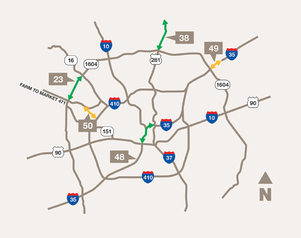
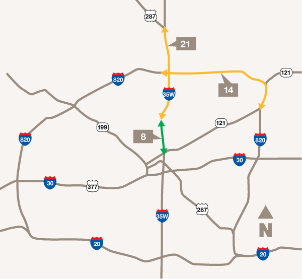
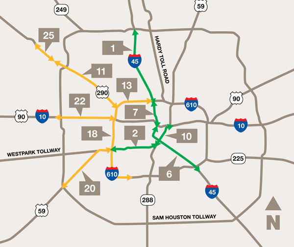
The maps on this page illustrate the locations of the biggest congestion problems in each of the four metropolitan areas in the Rider 42 study. The number marking each road section corresponds to the corridor's rank on the 2010 list of Texas' 50 Most Congested Roadways. (For comparison purposes, the most recent update of the 100 most congested Texas roadways can be found on TxDOT's website.)
Several of the 2010 sections were studied in detail. The following was prepared for each of these roadway sections:
- Congestion Reduction Plan – examines the possible causes of congestion, the projects recently completed or in progress, and planning efforts that are underway.
- Congestion Reduction Strategy Status – provides a comparison of over 50 of the most advanced congestion reduction strategies to national and state best practices.
The plan and strategy status provide a set of practical recommendations or "next steps" that could be taken to improve mobility in the corridor. Access more information about each strategy online.
Austin
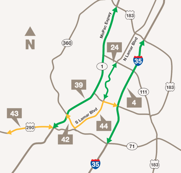
Section 4
IH 35 from SH 71 (Ben White) to US 183 (Research Blvd.).
Section 24
North Lamar from West 45th Street to West 6th Street.
Section 39
SL 1 MoPac from US 183 to US 290 West.
Section 44
S. Lamar/1st Street from West of US 290 to IH 35.
Dallas
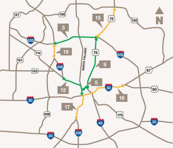
Section 9
US 75 North Central from IH 635 to Woodall Rodgers Freeway.
Section 16
IH 30 East RL Thornton from IH 35E to SH 12 East.
Fort Worth
Houston
San Antonio